The Truth About The Potential Future Supercontinent Amasia
When looking at the globe, it's easy to think that our current continental landscape, with its various nations and cultures, is the actual Earth. Go ahead and follow the advice laid out in John Lennon's "Imagine," and "imagine there's no countries." Think of all the frittering human feet amassed on patches of land, claiming it's theirs, rushing to work, chatting on cell phones, living, loving, mourning, dying. Beneath them all there's an Earth unperturbed and continual, and completely unaware of all the squabbles, pathos, and nonsense of humanity tromping on its face.
Fewer facts illustrate this truth than the continual tectonic shift of the land itself. While all the grass, soil, mountains, and seas appear unchanging, they only seem so in comparison to the brief candle of a human lifespan. About 117 billion of those lifespans have existed within the past 192,000 years, and that's only us, the most recent human species, as the Population Reference Bureau outlines. It's been 4 million years since the first human predecessor roved the land upright, as New Scientist describes. Every person from then 'til now has beheld an Earth that looks like ours — same continents, same land masses, same waters.
Anything alive from 336 million to 174 million years ago, though, would have seen a very different Earth: the merged supercontinent Pangea, as Earth.com explains. And 200 to 300 million years from now, anything alive might see the next supercontinent, Amasia, per Interesting Engineering.
The shape of the future
Recent research about Amasia comes from a study published in the National Science Review. Its title says it all: "Will Earth's next supercontinent assemble through the closure of the Pacific Ocean?" In a nutshell, you can forget about any discrete continents of Australia, Africa, Europe, Asia, Antarctica, and North and South America within 200 to 300 million years. By then, all the world's land masses might converge on the space currently occupied by the Pacific Ocean.
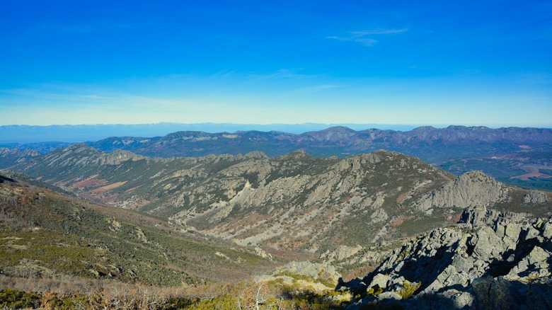
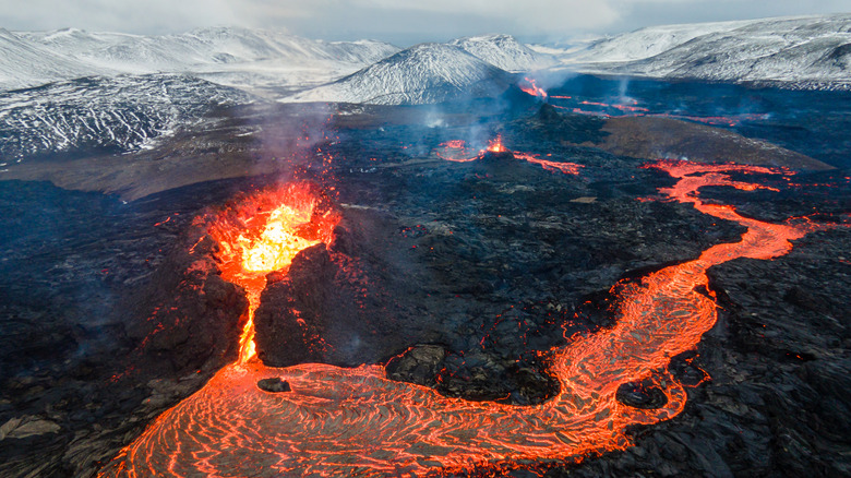
Researchers at New Curtin University in Australia came to these conclusions using 4-D geodynamic modeling of tectonic plates, which means that they used computer simulations to track changes in tectonic plates over time. Tectonic plates, remember, are the sliding eggshell-like segments of rock encasing the Earth. They move, but very slowly, at rates of only up to about four inches per year, as the National Weather Service describes. When tectonic plates move too quickly, or suddenly slip, we get civilization-leveling earthquakes. This is also how we get geological formations like mountains and volcanoes.
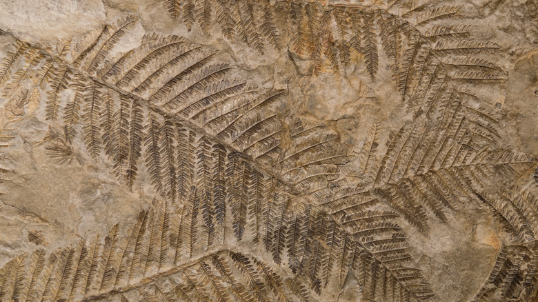
Given enough time, tectonic plate movement will shift entire patches of Earth's crust, and its above-water continents, to entirely new places. This is what's known as "continental drift," first proposed in 1912 by geophysicist and meteorologist Alfred Wegener, as Live Science explains. His work, largely dismissed at the time, is now universally accepted. Fossil records and rock formations verify plate tectonics — for instance, why the same freshwater reptiles existed in both South America and Africa.
The supercontinent cycle
So how likely is it that Earth's continents could take the shape of the supercontinent, Amasia? Well, we can't gauge things as a percentage or something, because that would require pulling apart the data in the original study published on National Science Review. But as The Weather Channel quotes the study's lead author, Dr. Chuan Huang, "Over the past 2 billion years, Earth's continents have collided together to form a supercontinent every 600 million years, known as the supercontinent cycle. This means that the current continents are due to come together again in a couple of hundred of million years' time."
We know that the supercontinent cycle is real, and that the often-cited supercontinent Pangea was only the most recent of the supercontinent bunch. Pangea (sometimes spelled Pangaea) dominated Earth from 336 million to 174 million years ago, as Earth.com says. It looked like a strip of land running north to south, with China in the far north connected to Russia, then the United States, South America, and Africa glommed together south of that, and then India, Antarctica, and Australia squashed together south of that. But before Pangea, there were the supercontinents Gondwona, Pannotia, Nuna (also called Columbia), Rodinia, and Ur.
Live Science states that the Earth's first continents started arising from the ocean between 3.3 billion and 3.2 billion years ago. This means that yes, all those ancient "cosmic ocean" myths — Babylonian, Indian, Polynesian, and the rest, per Ancient Origins — about the land rising from a primordial water world, are spot on.
Converging on the Pacific Ocean

So what could Amasia actually look like? While we can't say for certain — predictions spanning 200 to 300 million years in the future are tentative, after all — Interesting Engineering has a general, basic map. Judging by the looks of things, Australia may flow north and sidle up next to China, and then Antarctica might do the same to Australia from the south. South and North America may migrate west and press against the fused Asian-Australian-Antarctic continent, with South America locking into place along the eastern coast of Australia and Antarctica, and North America along the eastern coast of Asia. Africa and the Middle East would look basically the same, but Europe would sort of contort and squish its way south and east, and the Mediterranean Sea would vanish.
All of Amasia would be packed between 60 degrees latitude, north and south. In the modern age, that latitude cuts through the middle of Canada and Russia in the northern hemisphere, and midway between the southern tip of Chile and Antarctica's Trinity Peninsula in the southern hemisphere. Looking at longitude, the thickest patch of Amasia's land mass would be right about at 180 degrees, either west or right (longitude takes Greenwich, England as 0 degrees). That's almost exactly in the middle of the Pacific Ocean. All in all, the relatively small size of Amasia serves as a reminder that most of Earth's surface — over 70%, as the National Ocean Service says — is still covered in water.
Earth's puzzle-piece crust
Earth.com has an excellent little map of all the Earth's known tectonic plates, which fit together like puzzle pieces. Though there's general agreement about the main plates, there's some disagreement about how many there are in total, and their exact edges. There might be as few as 12 overall, or up to 150, with the smallest (278 square kilometers) being about the size of Edinburgh, the capital of Scotland (per World Cities Forum). But regardless, understanding tectonic plates can help us understand why they'd rearrange over time and slide into the new, potential shape of Amasia.
In general, tectonic plates come in two types: continental (jutting above the water to create land) and oceanic (only have water above them), as the BBC outlines. This means that the thicker plates stick up enough to produce the solid land where we walk, drive, and build houses. Many of these plates contain entire continents, like the South American plate. Others, like the tiny Juan de Fuca plate along the Pacific Northwest of the U.S., are oceanic.
As explained on Science Direct, the type of tectonic plate — oceanic vs. continental — has an impact on the plate's temperature and flexibility. This in turn influences whether or not plates will converge on an ocean and swallow it up, the way the proposed Amasia will converge on the Pacific Ocean. Plates can, generally, rotate east or west, or close in on the poles.
A world unlike our own
What would life be like on Amasia? That depends on whether or not humans still exist at that point, and whether or not they're chowing down on future-burgers or just prowling the vast void of the cosmos as disembodied consciousnesses. But for the rest of the world's ecosystem, Professor Zheng-Xiang Li on The Weather Channel says that Amasia's sea level would be quite a bit lower than our own, its interior really dry, and its daily temperatures much higher. In other words, the Earth of Amasia's converged continents would be very different from our present continental reality. We just happen to exist in an environmentally congenial, temperate time between supercontinents.
We might be able to look to Pangea for clues about Amasian life, though. In Pangea, as Science Daily says, mammals tended to stay in areas that got more rainfall, because they needed the water more than reptiles. Reptiles stayed in dryer areas with less rain. Because Amasia will have a dryer interior, we might be able to deduce that its exterior ring will be full of more mammals, while its central portions contain more reptiles. Temperatures in Pangea were also about 70 degrees Fahrenheit higher overall than the present; probably Amasia's temperatures will also be higher. This would affect plant and animal life across the board. But if folks really want to know what Amasia would be like, we'll just have to make sure that humanity survives long enough to see it.