Hector The Thundercloud: The Weather Phenomenon That Baffles Scientists
The differing weather around the world is fascinating to consider. It often seems that, wherever we live, we'd like to experience something else. Those who reside in cold or dismally rainy climates tend to enjoy summer vacations somewhere they'll experience guaranteed sunshine. In contrast, a beautiful, snowy skiing break can be just the ticket for those accustomed to hot and humid weather for much of the year.
Variety is the spice of life, as they say, and this is probably why we often seek something different on our often all-too-brief breaks away. It's a good thing, too, because unseasonal rainstorms, heatwaves, and other dramatic weather conditions can emerge out of nowhere and ruin the best-laid plans. In the song "Ms. Jackson," OutKast astutely put it this way: "you can plan a pretty picnic but you can't predict the weather."
Holidaymakers, Big Boi, and André 3000 might be surprised to learn of Hector the thundercloud, then. This dramatic weather phenomenon is actually very predictable indeed. So much so, in fact, that it arrives on a daily basis with almost perfect timekeeping.
Who is this Hector?
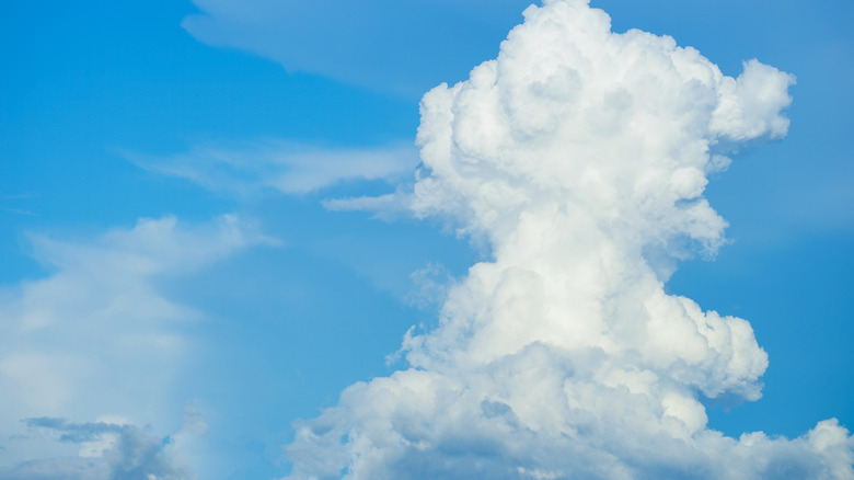
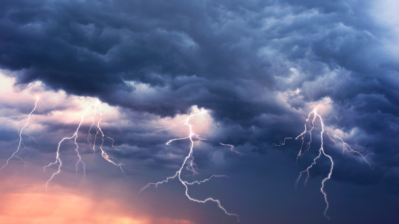
According to the Met Office, there's just one variety of clouds that brings us lightning and thunderstorms: cumulonimbus clouds. Alone, the outlet stated, these particular clouds (and the weather conditions that result) don't last very long, but large cumulonimbus formations can be intimidating prospects indeed. In these cases, formidable storms will ensue and can last for some time. As The Guardian reported, Hector the thundercloud is one such cumulonimbus formation.
For half of each year, it appears that Hector has a daily afternoon appointment above the Tiwi Islands of Australia, where the clouds appear in the sky every day at 3 pm. It sounds extraordinary, and that's because (as many experts attest) it is.
As the Australian Bureau of Meteorology's Ian Shepherd put it in April 2022 (per CNN), "Southeasterly trade winds extending from the subtropical ridge to the south will normally suppress thunderstorm activity over much of the Northern Territory during the late dry season (September) and at times early in the wet season (October and November)." Hector the thundercloud, then, is all the more unmistakable as a result.
The unusual shape of the Tiwi Islands
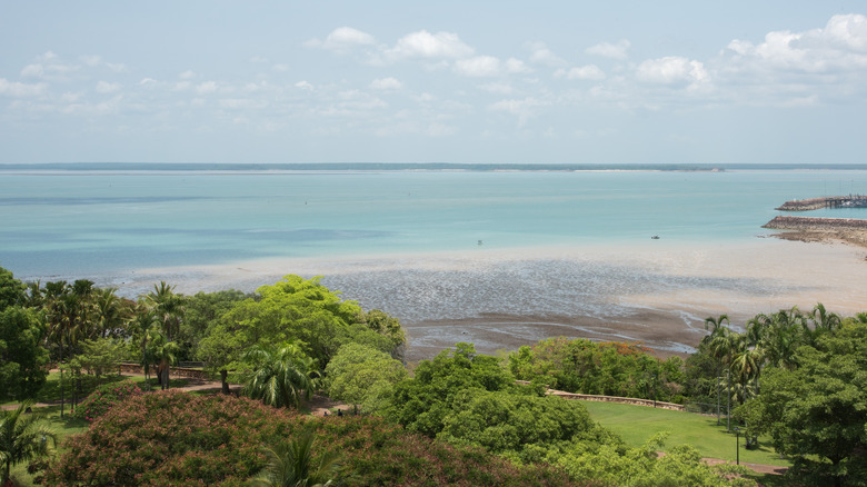
The clouds' appearance, per The Guardian, is influenced by the shape of the Tiwi Islands, and the way this sends winds from the ocean into the sky. Nate Byrne explained via the Bureau of Meteorology on YouTube that the stunning Tiwi Islands are "roughly shaped like pyramids where the sides all converge, so the sea breeze can rush up them to form a thunderstorm at the top." This is how the uniquely tall, stretched, and imposing cumulonimbus pattern comes together. It's also how, season-permitting, it continues to do so on such a dazzlingly regular basis.
In the Monthly Weather Review study "Understanding Hector: The Dynamics Of Island Thunderstorms" (via Zenodo), N. Andrew Crook created models to determine how island coastlines can lead to and influence cloud formations like Hector (known as convective systems). One such model used just one length of coast in order to tackle the topic of whether island formations are more effective at creating these convective systems. According to Crook, the results were not impressive, and so it seems that the Hector phenomenon's key to success is that "it develops over an isolated heat source where convergence is generated by two nearby coastlines."
As detailed by the National Weather Service, thunderstorms are very common on a global basis and generally not worthy of note or dangerous. There are typically around 2,000 such storms occurring worldwide. The unique circumstances of Hector, which warrant its rare naming, make it special.