One Of The Biggest Mistakes In Cartography History Involves California
Before our modern era of satellites and computers, cartographers didn't have an easy job trying to map the world. They had to rely on math, astronomy, and explorers, according to National Geographic. In the case of California, which for centuries was often mistakenly shown as an island off the coast of North America, it was an explorer's mistake that led to the confusion, among other problems that only made things worse.
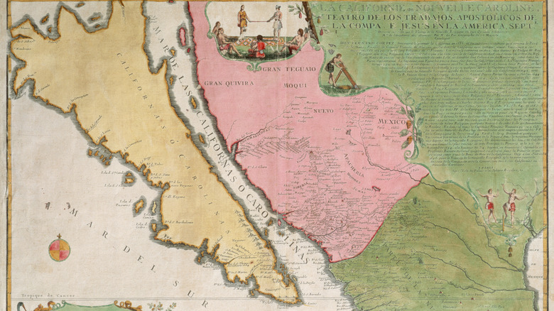
How this cartographic blunder got started and then continued began with a Spanish mutineer named Fortún Ximénez Bertandoñ who mistook the Baja California Peninsula in Mexico, to the south of the current U.S. state of California, for an island, per the San Diego History Center and "High Country Empire: The High Plains and Rockies." The mistake was helped along by a wildly popular 16th-century novel about a mythical island that would give the state its name, according to "The Phantom Atlas: The Greatest Myths, Lies and Blunders on Maps." From there, the mistake snowballed when the Dutch copied a stolen Spanish map, per Wired.
A popular book and Spanish Explorers
In 1510, the writer Garcí Ordónez de Montalvo, put out the first Spanish translation of a Portuguese novel called "Las Sergas de Esplandian," according to "The Mismapping of America." The book would become wildly popular. It described an island, which was full of Black, Amazon-like warrior women with golden weapons, and no men. The island, which was called California, was lousy with gold and jewels and lay "at the right hand of the Indies ... very close to that part of Terrestrial Paradise." Although the island of California was just a fantasy, some Spanish explorers took it to be a literal place.
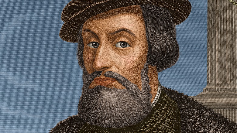
The Spanish conquistador Hernán Cortés was one of these true believers. He sent ships north from Mexico in search of this Amazonian island, according to "The Phantom Atlas." On one of these expeditions, Fortún Ximénez Bertandoñ killed the captain of his ship and led a band of mutineers, many of whom were themselves killed by Native Americans, to the tip of Baja California, per the San Diego History Center. Between the famous Portuguese novel and the 1,000-mile-long peninsula, Bertandoñ mistook the land for an island.
A theft compounds the problem
Cortés sent further ships that actually determined Baja California was a peninsula and for 60 years maps were accurate as to California being attached to North America, until another Spanish explorer, Sebastian Vizcaino, during a 1602 voyage once again mistook the Baja California Peninsula for an island, according to "The Phantom Atlas." But the explorer's maps and other important information from the voyage never made it to Spain.
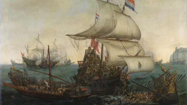
"The story is, the Dutch raided a Spanish ship and found a secret Spanish map and brought it back to Amsterdam and circulated it from there," Glen McLauglin, a collector of maps of the island of California told Wired. The Dutch thought they'd stumbled onto quite a find and quickly put out maps that featured California cut off from the coast. The mistake was replicated on later maps all the way up to its last appearance as an island on a Japanese map in 1865, according to Big Think. It's a good lesson about copying other people's work.