Bizarre Things That Were Picked Up On A Weather Radar
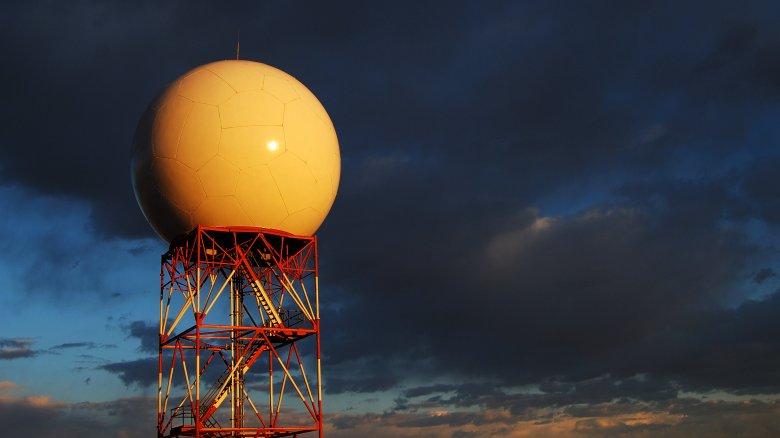
What's that weird, wet stuff falling out of the sky? Of course, you know it's rain when you're standing beneath the cloud, but to truly understand what's happening, why it arrived so fast, and where the storm is moving to next, weather radar (also called Doppler radar) is one of the niftiest tools of contemporary science. Now, not only can you warn someone across the country that it's about to hail on their wedding day, but you can also keep tabs on that big blue blob of snow rushing toward your mom's house without ever moving from your chair.
However, not everything you see on weather radar is ordinary weather ... or weather at all, actually. No, it's not aliens — though hey, if a UFO did touch down, this is probably the first place you'd see them — but the underlying causes of these colorful blobs can be equally strange.
Here come the ladybugs

Sometimes, as you walk through the woods, you'll find a ladybug sitting on a leaf. Cute, right? Occasionally, you might find a handful of them in your garden. A bit less cute, perhaps? The least cute thing of all, though, is when you witness a nightmarish red blob rising over the horizon, and find out that it's an 80x80-mile swarm of the little buggers. Yikes!
NBC reports that this sort of insane scarlet stampede showed up on the National Weather Service radar in June 2019, when it was found hovering over California's San Bernardino Country, and soon revealed by ground observers to be a seemingly endless armada of ladybugs. Before you allow this image of the great ladybug plague to haunt your nightmares, Time points out that the swarm didn't actually create a dense red cloud: According to meteorologist Joe Dandrea, spotters described the ladybugs as being more like little specks just flying past them. Furthermore, the National Park Service points out that such massive ladybug migrations are surprisingly common in California, as their eggs hatch in the spring, and they usually fly to the mountains in late May or early June. So next year, keep an eye on that radar...
Chaff it out

In December 2018, the Evansville (Indiana) Courier & Press wrote that eagle-eyed weather observers had noticed a mysterious blip on the radar, moving over Kentucky, Indiana, and Illinois. Due to low wind and temperatures, experts quickly ruled out a thunderstorm, but bizarrely enough, the radar return matched the strength of such a storm. Nobody could figure out what was going on.
Now, if this sounds to you like the ominous beginning of a science fiction movie — likely followed by a slew of alien spaceships swooping in — you're not alone, since the whole incident cracked open quite a Twitterstorm. ABC News reported that in reality the mystery echo was probably caused by a C-130 military aircraft, which had been spotted in the skies that day, releasing a stream of "chaff." Chaff is a catch-all term for radar-jamming material — such as thin aluminum, glass fiber, or plastic — used as a defense measure to confound enemy systems during warfare.
Why would the military do something like this on U.S. soil? While it was most likely just a training exercise or a big ol' accident, both of the nearby military bases have denied any association with the incident, which ... well, seems like a great way to get UFO fans hopping up and down with new theories.
When humankind creates snow
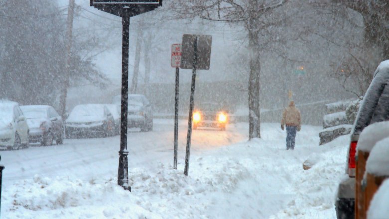
In the Marvel Universe, all it takes is either mutant powers or a mighty, mystical hammer to control the weather. Neither of these things exist in real life, though human beings have shown an (accidental) ability to cause snowstorms, much to the irritation of daily commuters.
How? Industrial power plants, weirdly enough. According to the Weather Channel, radar imagery has shown that the warm, moist air produced by power plants can, under the right conditions, rise up into the cold clouds and cause snow crystals to be produced. Though this crazy reaction has been studied in the past, the 2018 snowband of this type near downtown Cleveland was so noticeable that it led to the phenomenon being labeled the "Cleveland Effect" ... though really, that label is a bit unfair to those poor Ohioans, considering that the same industrial-produced snow happened in Indiana, Nebraska, Minnesota, and Kansas, at roughly the same time.
Regardless, if it ever happens in your town, you can now freely mutter obscenities at the local power plant when you're cleaning snow off your car before work.
Bat Country
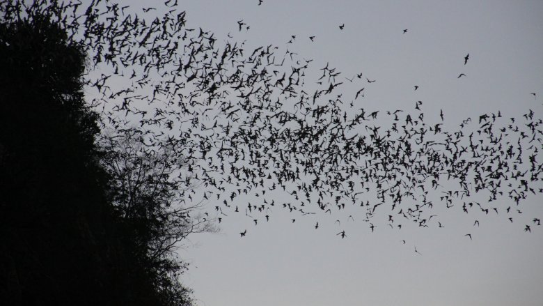
You'd probably only expect to see massive clouds of flapping, screeching bats in Gotham City, or perhaps Transylvania. However, bat parties are actually a common sight on Doppler radar. For example, on one hot Texas night in June 2016, so many of these creatures were flying around that the National Weather Service tweeted that "The Bat Signal is strong tonight!" likely scaring some of the more bat-phobic residents into staying home for the evening.
Honestly, though? Bats get a bad rap, considering all the hard work they do in eating mosquitoes, and the sad reality is that human activity has caused bat populations to decline across the board, according to Bat Conservation International. At least 53 species of bats are now endangered, another 24 species are critically endangered, and 104 populations are considered vulnerable. Interestingly enough, the fact that these winged creatures pop up on weather radar has been a boon to conservation efforts, according to Austin Bat Refuge co-founder Lee Mackenzie, as the data allows them to more effectively track populations, migrations, seasonal shifts, or behavioral changes that could signify a problem.
So hey, don't fear the bats: Instead, follow them on weather radar if you like, and hope for a batty future.
And for traffic, let's check out the weather radar
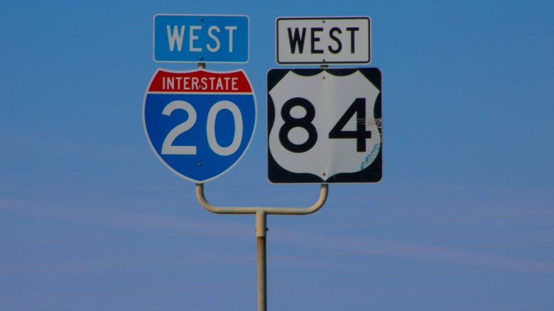
You might hate your daily commute, especially when your stomach is growling and you're stuck in rush hour traffic. But hey, at least your drive isn't showing up on weather radar. Weird as it sounds, this actually happened in 2016, when traffic on Interstate 20, west of Benbrook, Texas, was sampled by Doppler radar. Is that a thunderstorm or a '93 Geo Storm?
This phenomenon, known as ducting, occurs when a radar beam bends toward the ground, registering conditions at the terrestrial level. Anyhow, when the U.S. National Weather Service picked up on the traffic — which was moving at about 60 mph — they posted the bright pink blurs on their Facebook page, under the heading "Interesting Radar Phenomenon this afternoon." Honestly, the most "interesting" thing was probably those breezy speeds, considering the awful stop-and-go creep you suffer through on your way home every night. So 60 would be great!
This weather radar readout is for the birds
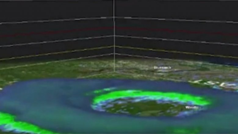
When the National Weather Service in Jacksonville, Florida, produced a three-dimensional radar image of a giant green explosion erupting on the landscape, you could be forgiven for worrying that a nuclear bomb had gone off. However, the Weather Channel says the scary-looking weather radar image was actually a massive flock of birds rising with the Sun, in unison, and taking off into the sky. A far more pleasant image, for sure. Studious Doppler radar observers have been watching bird explosions like this for years, since birds often wake up with the sunrise.
Radar technology has been an awesome addition to the toolkit of bird watchers, according to Scientific American, since it helps in tracking migration patterns: While those colorful blobs might look like a typhoon to the average person, a seasoned bird fan can use their knowledge of avian lifestyle patterns to identify what kind of bird population is moving where. The fact that bird movement can be identified via weather radar is also quite useful for the aviation industry, as airport terminals can make sure birds aren't in the way of airplanes to prevent any bloody accidents from happening.
California is burning
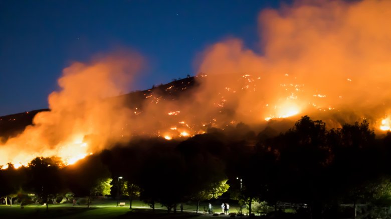
One of the scariest phenomena of the past decade has been the California wildfires. Hundreds of these infernos have engulfed the Golden State's countryside over the past few years, according to Time, destroying lives, land, and nature. The hellish images caught on video are otherworldly, and the possibility of more such fires breaking out still looms large. That's why in 2019 the state of California declared a year-long state of emergency so they could be ready for future environmental heatwave disasters.
The 2017 wildfires, according to Minnesota Public Radio, reached such a level of intensity that they popped up on weather radar. As hundreds of people died, thousands of houses were burned to the ground, and entire neighborhoods wiped out, the plumes of smoke became so thick and elevated that they were clearly visible from space. Doppler observers could only watch in horror as the destruction increased, knowing that the same horrible saga could (and would) play out again, year after year.
Oh no! What is that blip?

As the world becomes increasingly mesmerized by the weird and freaky things you can spot on weather radar, some observers have made a fun habit out of trying to deduce what the mysterious blips and blobs on their screen may be. For example, in 2017 a Twitter user pinged the National Weather Service of Billings, Montana, about an unusual orangey, reddish blip that had appeared on weather radar in otherwise serene weather. What could it be?
Well, the NWS investigated and came to the conclusion that it was a moving ski lift from the local Red Lodge Mountain ski resort. Womp womp. While this revelation certainly isn't the most exciting conclusion that one could hope for — an abominable snowman would've been a lot more exciting, obviously — it is pretty cool to know that weather radar can pick up such strange things. Maybe somebody should make a drinking game called "name the blip," where every inaccurate guess warrants a drink. To really complete the theme you could make tequila sunrises, hurricanes, or tornado twists.
Weather radar caught the flight of the (not) monarchs
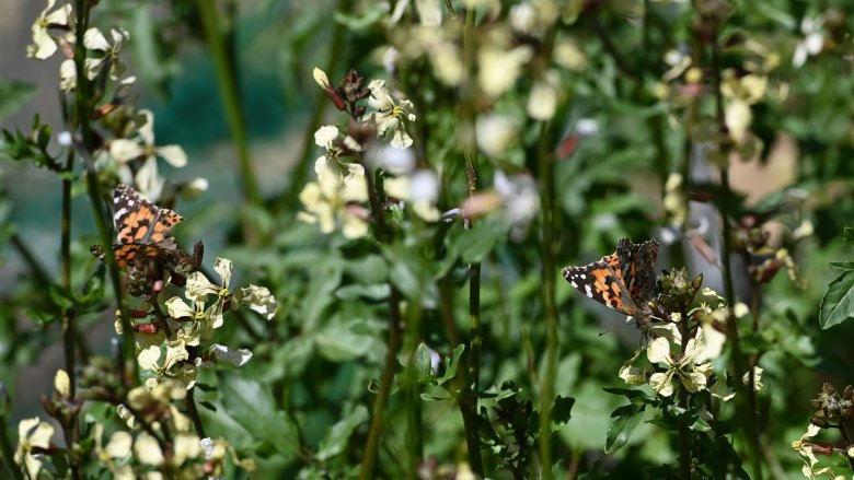
The sheer concept of a 70-mile swath of butterflies migrating through sunny skies sounds like something from a fantasy novel, but in 2017, Doppler radar found exactly that. According to the Weather Channel, meteorologists at the National Weather Service in Boulder, Colorado, originally figured that the weather radar echoes had to be birds, but incoming reports by ground observers — and social media photos, showing bushes and yards swarmed by the colorful insects — soon made it clear that it was just the biggest butterfly convention in recent memory. If there were ever a day to have a camera hanging from your neck, this was it!
One aspect of the story which was widely misreported by these observers, as USA Today clarifies, is that the winged bugs in question weren't the ever-popular monarch butterflies, but rather, a similar-looking species known as painted ladies. According to the Montreal Insectarium, the two butterfly types are often confused but can be differentiated by the patterns on their wings.
Honestly, though? You probably don't care what species you're looking at when 70 miles of them are flapping past your face.
Eye of the storm
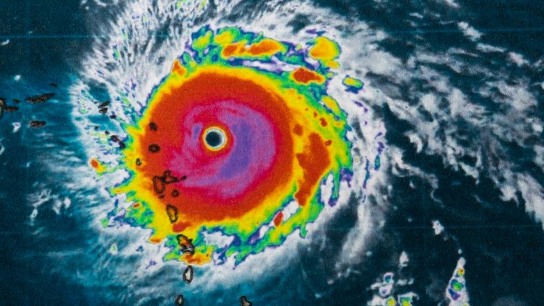
In 2016, as post-tropical cyclone Hermine touched down over the shores of Florida, according to Mashable, Doppler radar picked upon some rather unusual guests trapped in the eye of the storm: a whole bunch of seabirds. Oh no!
But wait, hold back your eulogies, and instead, prepare for a round of applause. As explained by Audubon, birds will often fly toward a hurricane's center once they get caught up in the winds, primarily because the eye of the storm is actually the safest place to be. While it's unlikely that these birds target the eye in any organized fashion, they tend to make efforts to stay there once they notice that being anywhere else in the vicinity is really freaking dangerous. No fun. Many birds will keep flapping around in the eye until the hurricane finally dissipates. It's probably a heck of a workout, especially without food or water, but hey.
When fake rain shows up on weather radar
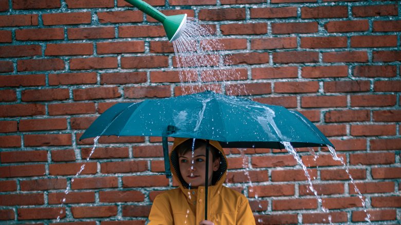
Listen, Doppler radar is great, but if you really want to know what's happening outside your front door ... please, just step outside or at least look out the window. Why? Because otherwise there will come a time when you'll be studying that little screen telling everybody about how a rainstorm is pouring down all around you only for the real sky to laugh down at you in blue, glowing, cloudless brilliance.
What's the deal? See, when fake rain or fake snow appears on Doppler radar, according to the Weather Channel, it's caused by ducting (when the radar beam bends down toward the ground). This is most likely to occur early in the morning after a colder night when the radar beam gets confused by the contrast between the cool ground air and the warmer sky air above it. Under these specific conditions, weather radar will present false echoes that appear to be rain but aren't.
Just remember, the weather radar isn't pranking you. It's just having a hard time waking up.