This Is What The Ancient Romans Thought The World Looked Like
The Roman Empire at its height spanned all the way through the tip of modern day Scotland, down to encompass all of Europe, out to Russia and into Turkey, and along the northern African coast, as depicted on Vlib. At its most expansive, arguably under the reign of Emperor Trajan (98 – 117 AD), social welfare programs for the poor increased (alimenta), aqueducts and shopping plazas were brought to far areas of the empire, but a mere 170 years later at about 284 AD it's agreed that the Roman Empire all but fell. Their branched system of government, unrivaled military power, deep body of laws, and meticulous written records have both guided and colored history. In addition to their accomplishments, the entirety of Roman history is also fraught with relentless bloodshed, in-fighting, coups, and assassinations.
For the glory of the empire
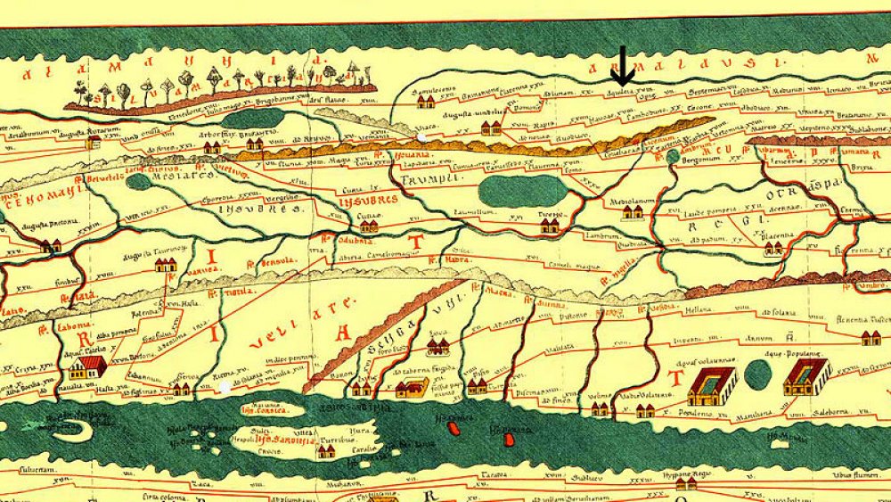
Roman technical skill, military power, political accomplishments, and pride, can all be glimpsed through the maps they used to describe their world. In the modern day, debate continues about the accuracy of flattened Mercator world maps and the cultural bias of Northern Hemisphere-centric maps, as described by Global Citizen. Many Roman maps are lost to history, but those that remain place Rome at the center of the world. They stop where the Roman empire ends, and describe the trade routes and the boundaries of the empire with immense accuracy. Maps such as the Tabula Peutingeriana, a 4th century map of roads, shows trade routes that lead all the way to India, while the Dura-Europos Route Map (dedicated to Emperor Alexander Severus, who ruled 222 – 235 AD) was etched on a soldier's leather shield as he marched to Crimea.
In this way, Roman maps were true to the empire's practical nature and militaristic outlook on the world, as depicted on History Hit. Even though there are few records about the methods that Roman cartographers used to chart their world, most maps were drafted for administrative purposes, use in warfare, or to proudly depict the power of Rome. Whenever Rome conquered a territory, its mapmakers didn't have an accurate vision of the newly subdued land, and at first relied on "disk maps," which place the horizon along the curved edge of a circular map.
Roaming the land
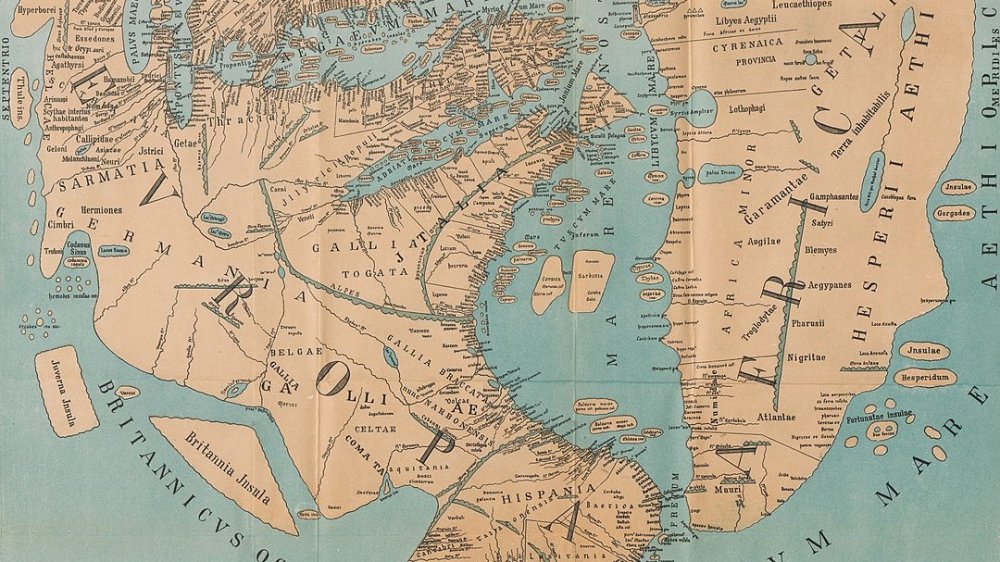
Roman general and statesman Agrippa (64 – 12 BC) was one of the first to develop their own versions of fully-charted, 2D maps of the empire. Agrippa's map, the Orbis Terrarum, was engraved in marble and placed on a public monument called the Porticus Vispania in Rome. The next individual to map out the Roman empire was a Greek geographer named Strabo (64 BC – 24 AD), who drafted a highly accurate map of Europe called Geographica, which included the UK and northern Africa, but of course expanded the boot of Italy to extra-large proportions. After him, a Roman geographer named Pomponius Mela (d. 45 AD) drafted a highly detailed map of the Roman Empire that split the world into 5 zones, and ended midway through Africa because the area was described as too hot to be inhabited. In all these cases, Rome is tellingly placed at the center of the world.
The accuracy of these maps, and the effort that went into their construction, are testaments to the influence and power of ancient Rome. They provide insight into not only how how the ancient Romans viewed themselves, but they help reveal what 21st-century maps tell us about our own self-identity.