The 500-Year Old Map That Shows Antarctica Without Snow And Ice
We may receive a commission on purchases made from links.
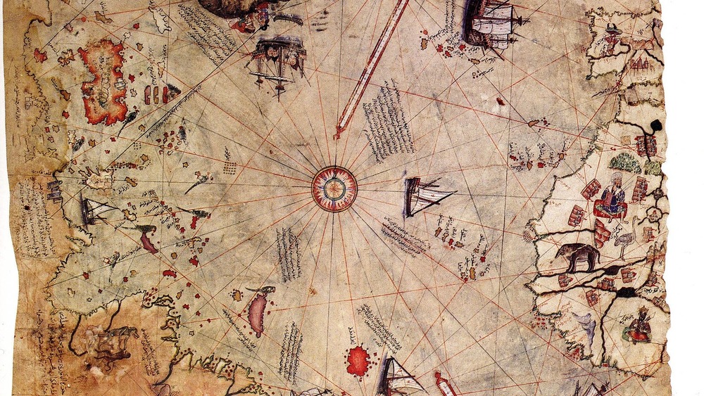
Maps usually clarify things, but in the case of a 500+-year-old gazelle-skin parchment called the Piri Reis Map, its discovery only created more mystery.
This fragment of a bigger map, found in 1929 by German theologian Gustav Deissmann as he catalogued artifacts for Istanbul's Topkapi Palace Library, seemingly depicted the Americas and Antarctica. "The map immediately attracted attention for its extensive annotations and the intriguing appearance of what appeared to be the American continents on a map just 21 years after Columbus's expeditions, and before other Western European expeditions were able to report their early discoveries with maps," noted Atlas Obscura.
The map was signed by Turkish cartographer Hagii Ahmed Muhiddin Piri, aka Piri Reis, and dated 1513. Besides working with maps, Piri Reis served as an admiral in the Turkish navy. He created several maps and wrote the Book of Navigation. According to The Vintage News, on an inscription on the map "he stated that he had used 20 different maps and charts as his source documents," including eight Ptolemaic (from 2nd century Greece), four Portuguese, one Arabic, and even one created by Christopher Columbus.
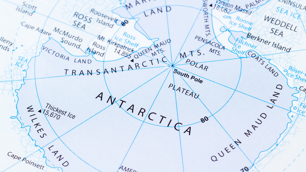
The interesting thing about the map showing Antarctica, though, is that the continent's discovery is usually credited to the explorer James Cook, who traveled there in 1773, more than 250 years after the map's creation, according to All That's Interesting. The Piri Reis version of the area also peculiarly contains no ice cap. The last time Antarctica was defrosted happened more than 6,000 years ago.
Ancient cartographers and their maps
The mystery deepened when Professor Charles Hapgood wrote Maps of the Ancient Sea Kings in 1966, according to Paul F. Hoye , in the article, "Piri Reis and the Hapgood Hypotheses" in Aramco World magazine (posted at Diegocuoghi).
He and his students at Keene State College in New Hampshire poured over the map and found other eccentricities, including that it contained methods similar to the Mercator Projection, a method that European mapmakers only adopted in the late 16th century, according to Ancient Wisdom. Named after Flemish cartographer Gerardus Mercator, the technique, created in 1569, used cylindrical map projections.
Professor Hapgood hypothesized that the Piri Reis Map might have used information from time periods older than 4000 BCE and thought that perhaps ancient civilizations traveled by sea more than previously thought. "Professor Hapgood went on to state that the topographical representation of the area inland from the coast was so accurate that this ancient super-civilization had to have aerial capabilities in addition to their nautical and cartographic abilities. This naturally led to a theory of an alien civilization or one based on the lost city of Atlantis," according to Vintage News. Skeptics scoff at this and say the map might just depict South America, and what some believe is Antarctica is merely just a lower section of the other continent.
The map itself still resides in the Topkapi Palace Library archives in Istanbul, Turkey.