The Origin Of Downtown Chicago's The Loop Nickname
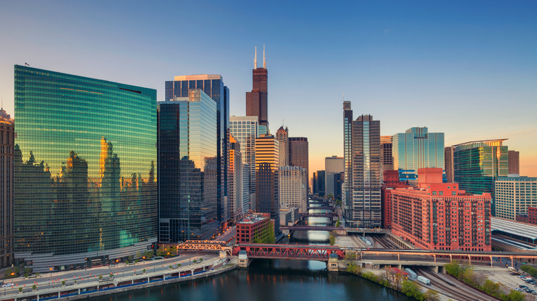
As many Chicagoans will tell you, "the Loop" is the heart of downtown. It's bordered by the Chicago River to the north and west, Lake Michigan to the east, and Roosevelt Road to the south.
The area was home to Potawatomi Native Americans until 1833, when they were forced west. Before that, white settlers had already built a trading post in the area, as well as Fort Dearborn (via WTTW).
Chicago's population rose to 300,000 by the 1870s, but in 1871, a massive fire destroyed most of what's now the Loop. The city rebuilt, including some of the first-ever skyscrapers. In fact, Chicagoans claim that the 10-story Home Insurance Building from 1885 was the very first skyscraper. Many others were built along S. Dearborn Street (via WTTW). According to the Encyclopedia of Chicago, this period of massive rebuilding led to improvements in Chicago's public transportation system, starting with cable cars in 1882. Electric trolleys followed in 1902, then elevated trains, and finally the subway in the 1930s.
How The Loop got its name
There's some debate about the origin of the name "the Loop," according to Doorsteps. Some say it goes all the way back to cable car days, when an underground pulley in the city's center turned the cars around on their tracks. The pulley system was "the loop."
According to WTTW, Chicago's cable cars replaced older, horse-drawn cars. These cars were slow, and some were concerned about the treatment of the animals that pulled them. Instead, cables pulled the cars forward. Turning cars required a force of about 125 pounds to turn when a conductor turned them instead of a pulley. Though the cars only ran for 24 years in Chicago, they were influential in other cities' decision to adopt them as well.
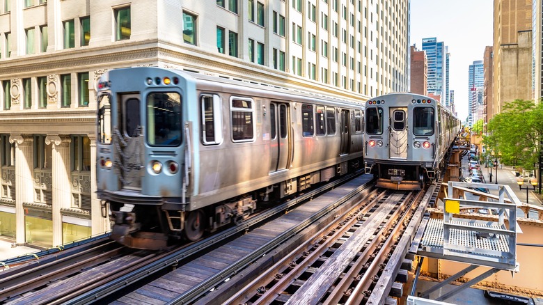
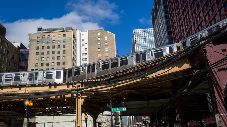
Others say the nickname is slightly newer, referring to the ring created around the city's core by elevated train tracks, completed in 1897 to connect to suburban train lines. This ring, which still exists, is "the loop." The tracks reinforced that central area's importance (via the Encyclopedia of Chicago).
The history of the L
The building of the iconic elevated system from which the Loop may take its name began in 1892. According to Loop Chicago, the growing population of Chicago was causing serious traffic congestion downtown, which wasn't alleviated by the cable cars. Chicago needed either an underground or overground system, and elevated trains were less expensive to build than subways. The inaugural journey of elevated trains ("the L") was June 6, 1892, and covered 3.6 miles in 14 minutes.
The original trains were basic steam trains on elevated tracks, but the following year, inventors at the World's Columbian Exposition in Chicago introduced the third rail electrical power system. It was used to transport fairgoers around the grounds, and later was applied to the L. By 1897, the L had three train lines, but none of them served what is now the Loop. Businessman Charles Tyson Yerkes got permission to build in the center of downtown — not an easy thing — and constructed the majority of the Union Loop. By 1921, the L had the basic shape it still has today (via Loop Chicago).
The State Street and Dearborn Street subway stations were built in the 1930s and 1940s, and in 1945 the Chicago Transit Authority (CTA) was founded. The CTA has made further changes to the system since then, including retiring wooden train cars, introducing air conditioned train cars, and extending the lines to Chicago's airports (via Loop Chicago).
Living in the Loop
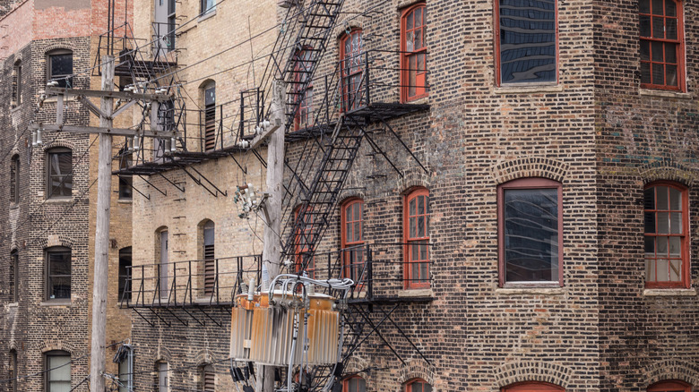
The creation of public transit lines to the suburbs hastened the exodus of the city's elite from downtown. Most moved to suburbs along Lake Michigan. Downtown Chicago was dirty, with polluted air and sewage flowing in the streets. However, the poor remained living in the city center, in tenements, because they couldn't afford to commute to and from their jobs at the city's factories and shops. Nonetheless, the city remained the center of business, so expensive new buildings sprung up there beginning in the 1880s and 1890s (via Chicago Detours).
Certain ethnic groups populated different parts of downtown, including Germans, Irish, and African Americans, according to the Encyclopedia of Chicago. Several railroad depots circled the city center, and beyond those were neighborhoods of cheap housing. These areas were also vice-filled, contributing to downtown Chicago's bad reputation.
In the early 20th century, even more people began moving out into the suburbs, but downtown remained a social and economic hub for most Chicagoans until about 1950 (via the Encyclopedia of Chicago). The Loop saw its traffic peak in 1948, with around a million people coming and going from the area each day. After a downturn, there was a slow influx of new residents to the Loop in the late 20th century, but urban renewal projects displaced many homeless people, according to Chicago Detours.
State Street: the heart of the Loop
Running along the eastern side of the Loop, just a couple of blocks from Lake Michigan, is State Street, which has long been one of the commercial centers of Chicago, and particularly of the Loop. According to Loop Chicago, the area was originally a shopping outpost for settlers headed west, the last chance to buy supplies before heading into the wilderness. In 1831, the Illinois State Legislature approved the construction of a state road in the area to connect Vincennes, Indiana, to Chicago. This is how the street got its name.
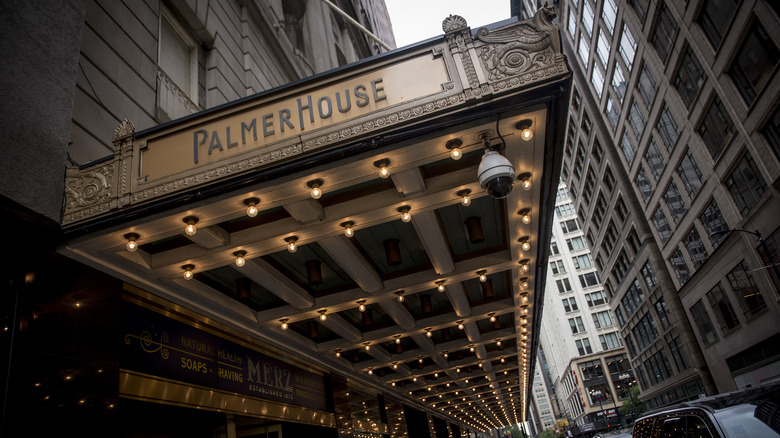
Its prominence increased after the Civil War, when businessman Potter Palmer attracted more shops to the area by building his Palmer House Hotel on State Street (and rebuilding it after the 1871 fire). The street remained a retail center until after World War II, when the rise of suburbs created an economic downturn in the city.
The city tried to revitalize the area by creating a pedestrian mall on State Street in 1979, closing nine blocks to private automobiles and installing new bus shelters and wider sidewalks, among other improvements. However, the plan failed. It separated the street from the rest of downtown and took away its energy. The heavy bus traffic to the mall also created an unpleasant atmosphere (via Chicago Tribune). The mall closed in 1993. Instead, city officials invested in new developments, including building offices and apartments and revitalizing the Theater District (via Loop Chicago).
The Loop today
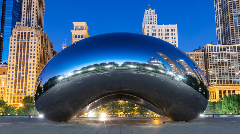
Today, the Loop is still a commercial center, but also a residential area and a dining and culture destination. According to Britannica, the area is decorated with outdoor artwork by Alexander Calder, Marc Chagall, Joan Miró, and Pablo Picasso. In the Theater District, three theaters feature touring Broadway shows, while others host world premieres. Along the riverside in the Loop is Chicago's Riverwalk, a pedestrian-only area with restaurants and the Chicago River Museum, among other things. On the Loop's lakefront is Millennium Park, home of the "Cloud Gate" sculpture, aka "the Bean" (above). The park also features a garden area and the Jay Pritzker Pavilion, which hosts music and movie festivals (via Choose Chicago).
Some other attractions in the Loop include the Art Institute, one of the largest and oldest art museums in the country, with exhibits of Impressionist art, among others. Nearby is Chicago Cultural Center, which hosts free exhibits and shows and features the world's largest Tiffany stained glass dome.