The Untold Truth Of GPS Technology
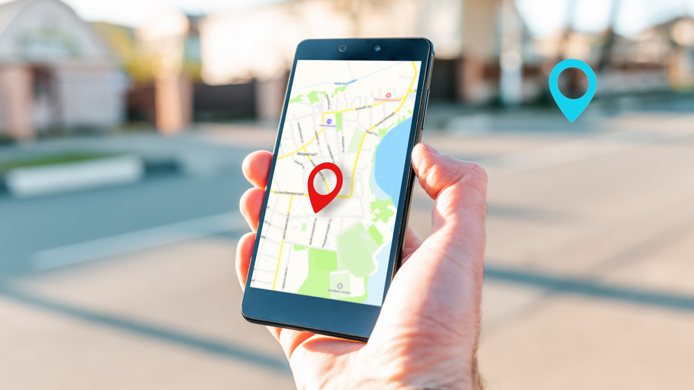
You're completely lost. You have no idea where you are. You're in a new city and you can't find the cafe you're looking for. What do you do? Luckily, you live in the year 2021, so you just take out your phone, open an app, and you're just a few finger taps away from finding exactly what you're looking for. You order an Uber and someone you've never met before drives to your exact location. Once you arrive, you snap a selfie with your latte and carrot cake, and post it to social media along with the location of the business.
It's something we take for granted now that we're a few decades into the 21st century and we all carry around world-changing devices in our pockets like it's no big deal. But there's a lot more to the Global Positioning System, or GPS, than finding where you'll eat your next meal. Recent moves by countries like Russian and China to create their own Global Navigation Satellite Systems (GNSS) have put the United States in a vulnerable situation, as the country has grown more and more dependent on the service for everything from take-out to ATM transactions. As it becomes more integrated in our everyday lives, changes to GPS could have significant effects on our safety in the years to come. Let's take a look at the history of GPS, how it works, and how it is set to change in the near future.
GPS started back in the space race days
According to All About Circuits, GPS started back in the days of the space race between Russia and the United States. In September 1957, scientists from the United States and the Soviet Union gave presentations on their countries' respective satellite programs at a conference hosted by the National Academy of Sciences in Washington, D.C. Much of what they talked about included satellites transmitting radio signals as a means of tracking orbits and confirming successful launches. The U.S. scientists tried to get their Soviet counterparts to give them some information on how close they were to launching a satellite, but were only told that one was coming soon.
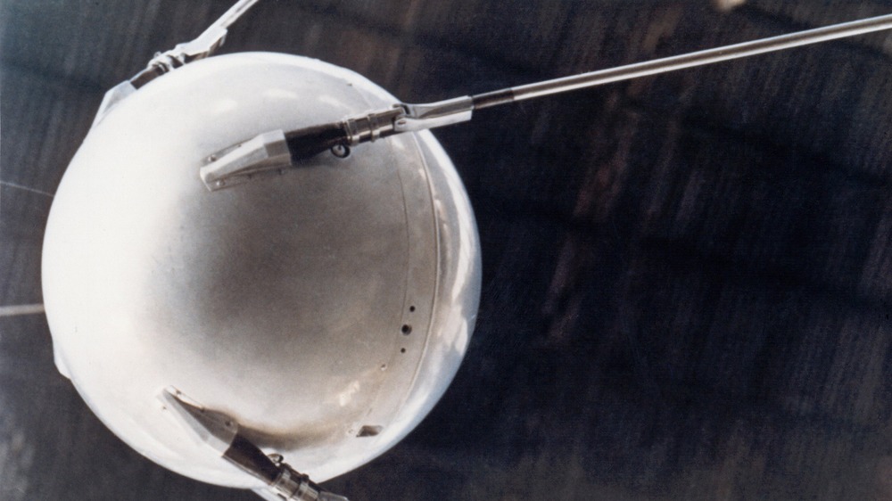
Then on October 4, 1957, the Soviet Union launched Sputnik I, the first man-made satellite, into orbit, effectively winning the space race. The news caused a sensation, and as Space.com remembers, many Americans felt that the country might be losing some of the global dominance it had enjoyed since the end of World War II. However, although Sputnik did mean that the Russians had won the race to put the first man-made object into space, it also created a unique opportunity for the United States, one that its military did not waste time taking advantage of. On October 7, 1957, The New York Times reported that Soviet scientists were using the Doppler effect to track Sputnik's orbit.
How GPS works
Named after Christian Doppler, the Austrian physicist who postulated the principle, the Doppler Effect is the phenomenon of how the observed frequency of waves — such as audio, visual, or radio waves — changes depending on the relative motion of the source and the receiver. To put it more plainly, it's the change in pitch in a police siren as a patrol car races past you in pursuit of a suspect. What happens with a satellite is that the frequency of the radio waves it emits drops dramatically when the satellite is directly overhead, at a 90-degree angle from the receiver on Earth. This tells us where the satellite is in its orbit.
But scientists at Johns Hopkins University Applied Physics Laboratory wondered if they could use this data to flip the situation around. Could they determine the location of an object on Earth based on Doppler effect data from orbiting satellites? The answer was yes, and the concept of a Global Positioning System was born.
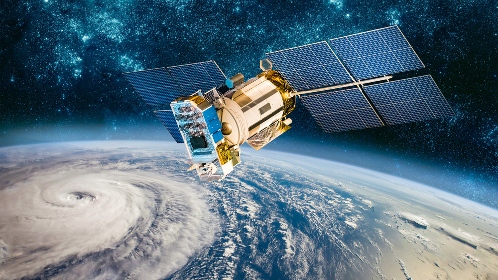
NASA does a pretty good job of making topics as complex as GPS understandable for those of us who would otherwise chalk our smartphones' impressive capabilities up to magic and just order a pizza already. A network of over 30 satellites is in constant communication with ground stations and receivers, i.e., your phone, to determine your latitude, longitude, altitude, and time. It takes at least four satellites to accurately locate your phone on the ground.
Time moves faster for GPS satellites than it does for us on the ground
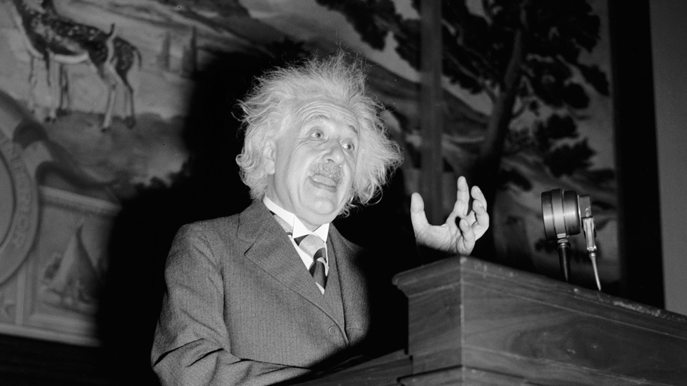
We all know Albert Einstein as that kooky but super smart guy with his wacky hair and his tongue stuck out and his E=mc2. But most of us have little to no idea what that formula means. We assume it only relates to stuff like black holes or the Big Bang. And those of us who do are almost correct in thinking that. But according to Physics Central, there's one exception to the astronomical exclusivity of Einstein's famous theory of general relativity. You might not expect it, but E=mc2 is actually integral to your everyday life in the 21st century. Without it, you would have to use paper maps or get directions to that cafe, like, by asking another person.
That's because time actually moves faster for GPS satellites than it does for us down here on Earth. For one thing, they're moving much faster than earthbound clocks, which makes them tick more slowly, by about seven microseconds a day (a microsecond is one millionth of a second). Gravity, however, is four times weaker up there than it is down here, and as a result, satellite clocks tick a tiny bit faster — about 45 microseconds a day. Our understanding of this — thanks to Einstein's theory — allows us to adjust for the discrepancy, which, although it doesn't seem too great, would cause major navigational problems if we didn't.
The US military-operated GPS has been the most widely used network for years, but that could soon change

According to NASA, the basis for today's GPS system was created by the Department of Defense in the 1970s. The first satellite of the Navigation System with Timing and Ranging (NAVSTAR) was launched in 1978, and the network was completed and became fully operational in 1993. Ever since then, all GPS has been owned by the U.S. government, and although it now meets a wide range of non-military purposes, such as finding that cafe you wanted to see on your trip to New Orleans, it is still operated by the Air Force, or, more specifically, the Space Force.
For decades, the U.S. GPS system has been the most reliable and widely used GNSS in the world, but that dominance has seen some challengers in recent years. As Geospatial World reports, several countries have also created their own GNSS systems, and some now have global coverage completely independent of U.S. satellites. The European Union's network is called Galileo. Japan has the Quasi-Zenith Satellite System (QZSS), and India's is called NAVIC (Navigation with Indian Constellation). Those of Russia and China are of the most advanced systems outside the United States. Russia's GLONASS (Global Navigation Satellite System) started with 12 satellites in 1993, but it has since grown to a 27-satellite system with global coverage comparable to the U.S. system. China's BeiDou GNSS, however, is the biggest worry to the United States at the moment.
China just created its own global positioning system independent of US satellites
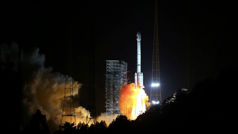
In the summer of 2020, China launched the last of 30 satellites for its BeiDou global navigation system. CNBC reported that the system now rivals the U.S. GPS system, and this could spell trouble for the United States if the two countries were to get belligerent with each other in the future. Experts said that the fully functional BeiDou system, with its own global coverage wholly independent of U.S. satellites, means that China would maintain full navigational capabilities in the event of a military conflict. Before BeiDou, had China threatened the United States with military force, the latter could just cut off the former's access to the GPS network, and China would have been effectively blinded. Now that option is off the table.
According to NPR, the BeiDou system is part of a larger global project called the Belt and Road Initiative. China has spent several years and billions of dollars on infrastructure projects across the globe, such as highways, bridges, ports, and more, and much of this has been built with smart technology that can be tracked by BeiDou. Experts fear that this initiative could solidify China's influence beyond its borders, and that the BeiDou system could even allow China to track individuals in real time anywhere on the globe.
So, now that you know the untold truth about GPS and the direction it's headed in the future, it's probably best to just enjoy your ability to order an Uber or a Domino's pizza while you can.