How Does A Thunderstorm Become A Tornado?
Nature has a way of inspiring both awe and fear in millions. Yet, often the most remarkable scenarios are also the most dangerous. Such is the case with tornadoes. These massive wind tunnels happen all around the world, though they are most common in the United States. Specifically in a region known as tornado alley. Tornado alley is a group of states in the midwest where tornadoes occur most frequently. However, according to World Population Overview, tornado alley appears to be migrating east.
Due to the infamy of tornado alley, many people have been led to believe that tornadoes are only possible in flat landscapes. This is a dangerous myth, as the blustering giants can occur anywhere and have the ability to cross a multitude of obstacles, including valleys, cities, and bodies of water (per Weather.gov). Tornadoes can be the cause of devastation and are often unexpected though there are a few weather conditions necessary to create the perfect tornado brewing atmosphere, starting with a thunderstorm.
Weather conditions have to be harsh to create a tornado
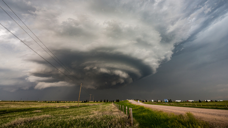
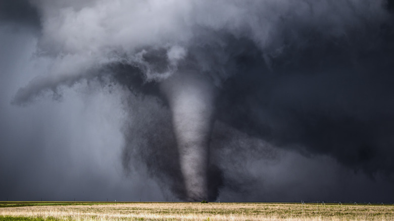
Tornadoes don't just drop down on clear days when there's not a cloud in the sky. The weather leading up to a tornado can be a chaotic precursor for what's to come. Usually, thunderstorms are needed for the formation of a funnel cloud. When warm air rises and clouds grow taller, a thunderstorm begins. As thunderstorms grow, they can become rotating thunderstorms and, finally, supercells. According to a statement from the National Oceanic and Atmospheric Administration published by CNN, "Nearly all supercells produce some sort of severe weather (large hail or damaging winds), but only 30 percent or less produce tornadoes."
Inside the supercell, the heavy winds change direction with height. This is called wind shear and gets the air inside the supercell spinning. While the wind shear is getting things spinning, a downdraft of drier air is pushing down inside the supercell, wrapping around the backside of the storm and causing a horizontal column of air to drop down (per CNN). This horizontal column is the funnel cloud that will become the tornado.
According to the National Oceanic and Atmospheric Administration, around 1,000 tornadoes are reported each year in the United States. These tornadoes are rated on a damage scale of F0 to F5, called the Fujita Scale. Wind speeds of 40 to 72 miles per hour are considered an F0, and wind speeds of 261 to 318 miles per hour are considered an F5 and are expected to cause incredible damage (per Insurance Information Institute).
Tornado chasers wait for just the right thunderstorms
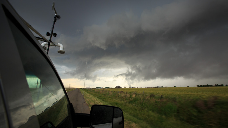
Some tornadoes cause little to no damage, but some can leave a path of devastation. The strongest winds ever recorded happened during a tornado in 1999 in Bridge Creek, Oklahoma. The winds from the storm were over 300 miles per hour (per CNN). The danger of tornadoes sends most people heading for shelter and safety to wait out the storm. While others actually pursue tornadoes hoping to get close enough to photograph and study them.
Brandon Miller is a meteorologist and a storm chaser who has seen over 15 tornadoes over the years because he actually seeks them out when others are trying to stay far away. Miller said in a statement to CNN, "There is no denying that there is a certain amount of excitement that comes from seeing a tornado when you are set out with the intent of seeing one. At the same time, you are balancing that excitement with a sizable amount of anxiety and concern over what the tornado could do, especially if there are residents in the immediate path of the storm. As someone who spent years studying, and many more years reporting on tornadoes, it still gets all my nerves firing when you see a tornado in person."
Tornadoes are a difficult subject to study without getting in harm's way, and even as scientists learn more about them, the danger remains very real.