What Is A Phantom Settlement And Do They Really Exist?

A map is a great tool to have if you're going on an adventure in an unknown place, but some maps can be deceiving. You may come across the name of a phantom settlement — also known as a paper town or trap street — and find nothing when you get to that location. Phantom settlements, as noted by the Future Mapping Company, are fictitious towns or streets included by cartographers for copyright protection. It serves as a watermark of sorts that only the map maker is aware of.
Maps, like works of art, can be copied, and map makers added a phantom settlement to their maps for security. In the event that they come across a map from a different source that includes the name of the phantom settlement they added, they have proof of copyright infringement. In some cases, the change to the map is more subtle, such as making a street more narrow, increasing the elevation of a mountain, or adding a bend to a road. Ultimately, these small changes are meant to catch those who copy maps and are not too major that anyone using the map will get lost.
One of the most popular phantom settlements
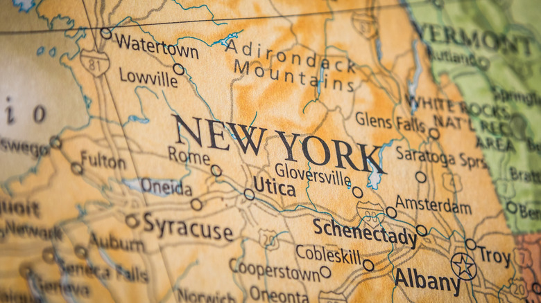
One of the most well-known phantom settlements was supposedly located in New York and was created in the 1930s. The story of this phantom settlement is somewhat confusing, as the fictional location became real before vanishing again. The General Drafting Corporation (GDC) was founded in 1909 and was one of the biggest map publishers until the 1970s (via Geographicus). In the 1930s, the company was commissioned to create a map of New York. Its founder and director, Otto G. Lindberg, and his assistant, Ernest Alpers, decided to add a phantom settlement of a town they named Agloe — an anagram of their initials. They plotted it at an intersection along Route 206, and the location where Agloe was supposed to be was, in reality, a dirt road.
Years later, as noted by Treehugger, GDC's competitor, map company Rand McNally, produced a map of New York, and it included a town called Agloe right in the same location where GDC placed the phantom settlement. Lindberg was sure that he had a copyright case against his competitor, but the issue wasn't so clear-cut.
The case went to court

GDC and Rand McNally battled it out in court. Despite the evidence of copying, Rand McNally was able to defend its addition of Agloe to its map. As reported by NPR, Rand McNally testified that its map makers used county records as a resource for the map, and in it was Agloe and an establishment called Agloe General Store. It turned out that the store owners used a map from Esso, a company that owned gas stations and one of GDC's clients. Upon seeing the name Agloe on the map where they wanted to build their business, they decided to name their store after the supposed town's name. The establishment of a general store was enough for the county to list Agloe, which was supposed to be a phantom settlement, as a real town in their records.
For a while, as noted by Now I Know, Agloe was included in maps. The Agloe General Store didn't last that long and was eventually permanently closed by its owners, as running a business on a dirt road wasn't the most profitable idea. The town existed for decades and grew to include a couple of houses and one gas station, but they have since been abandoned and dismantled. Eventually, Agloe was removed from maps as well, and today, the only proof that it ever existed is a sign that reads, "Welcome to Agloe! Home of the Agloe General Store."
Phantom settlements in Michigan

There were two other phantom settlements in the U.S., specifically in Michigan, but they weren't placed there for copyright protection purposes. Instead, it was added to honor one man's love for his alma mater's football team. Between 1978 and 1979, some of Michigan's road maps included two phantom settlements named "goblu" and "beatosu." The new additions were written in all lowercase letters, unlike the other locations that were properly printed.
At that time, as reported by LSA Magazine, the chairman of the State Highway Commission was Peter Fletcher, a graduate of the University of Michigan. He asked the cartographer to add the phantom settlements, which when analyzed meant, "Go blue," in reference to his school's signature color, and "Beat OSU," which referred to Ohio State University, his school's rival. These were often chanted during football games. The map didn't go into mass production, and the prints that included the phantom settlements are considered rare collector's items.